SC Trails

Trail Activity:
- Walk
- Paved
Length:
Difficulty: Easy
This community center is located in Lynchburg (Sumter County) and offers a playground area, picnic shelter and a peaceful walking path.

Trail Activity:
- Walk
- Hike
Length:
Difficulty: Easy
Silver Bluff Audubon Center and Sanctuary offers miles of walking trails winding through the property along with viewing birds and other wildlife at the Wood Stork foraging ponds.

Trail Activity:
- Walk
- Hike
Length:
Difficulty: Easy
The Sims trail is an easy hike that connects the Boardwalk to the longer Weston Lake Loop Trail, and follows an old gravel road.

Trail Activity:
- Walk
- Hike
Length:
Difficulty: Easy
The Sinkhole Pond Nature Trail—located within Santee State Park—leads to the namesake pond, created when the limestone underneath the surface eroded away opening a large hole in the ground.

Trail Activity:
- Walk
- Bike
- Paved
Length:
Difficulty: Easy
This paved trail is a Swamp Rabbit Trail spur located near Green Forest Park offering art installations and views of the Reedy River.

Trail Activity:
- Walk
- Paved
Length:
Difficulty: Easy
This City of Aiken park provides a nice greenspace for the community, a basketball court, tennis courts, as well as a looped walking path for an afternoon stroll.

Trail Activity:
- Walk
- Hike
Length:
Difficulty: Easy
This preserve is well worth taking some time to explore and discover some ancient history on Coosaw Island.
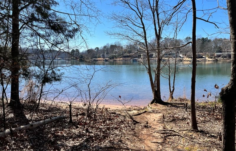
Trail Activity:
- Walk
- Hike
- Bike
- Mountain Bike
- Water
Length:
Difficulty: Easy
The lake shore is thickly forested with mostly pine, and the lake itself is large with many inlets and coves to explore. Over 200 species of birds call this area home, including waterfowl, shorebirds, woodland birds and even the occasional peregrine falcon and bald eagle.

Trail Activity:
- Walk
- Bike
- Paved
Length:
Difficulty: Easy
This multi-use trail travels along Neely Road and Rawlsville Road—from South Pointe High School to Crawford Road. It was installed to provide a safe route to nearby schools and parks.